Unsere technologieabhängige Zukunft hängt von der Ausfallsicherheit des Stromnetzes ab. Energieversorger stehen unter enormem Druck, das Netz zu modernisieren und seine Ausfallsicherheit zu optimieren, damit es energieintensive Rechenzentrumsprojekte bewältigen und gleichzeitig Haushalte und Unternehmen weiterhin zuverlässig versorgen kann. Sie müssen veraltete Infrastruktur modernisieren und Anlagen der nächsten Generation einführen, die den Energieanforderungen von morgen trotz zunehmender klimabedingter Bedrohungen gewachsen sind.
Dieser Artikel bietet Einblicke in diese wichtigen Trends, die den Wandel im Stromnetz vorantreiben, und zeigt auf, wie Netzbetreiber KI-gestützte Feldwerkzeuge einsetzen können, um ihren Betrieb zu optimieren und neue Herausforderungen zu meistern.
Hauptthema Trends, die die Zukunft des Energienetzes prägen
Rechenzentren treiben den Strombedarf an
Das Stromnetz ist das Rückgrat einer KI-gestützten, „Cloud-first“-Welt. Regierungen weltweit bemühen sich aus Gründen der Souveränität und Sicherheit darum, Projekte für Rechenzentren anzuziehen, während Unternehmen das Potenzial des KI-Booms nutzen möchten. Der Erfolg jedes Rechenzentrumsprojekts hängt von der Verfügbarkeit von Energie ab. Vor Baubeginn müssen die Entwickler von Rechenzentren wissen, dass das Stromnetz für den Energiebedarf des Projekts gerüstet ist, und sie möchten sicherstellen, dass sie so schnell wie möglich ans Netz angeschlossen werden.
Das US-Energieministerium schätzt, dass der Energiebedarf in den nächsten zehn Jahren um 15 % bis 20 % steigen wird, während das Electric Power Research Institute (EPRI) davon ausgeht, dass Rechenzentren bis 2030 bis zu 9 % des US-Stromverbrauchs ausmachen könnten. Die US-Energieinformationsbehörde schätzt, dass allein die Server in Rechenzentren bis zum Jahr 2050 zwischen 446 Milliarden Kilowattstunden (BkWh) und 818 Milliarden BkWh verbrauchen werden.
In einigen Provinzen Kanadas übersteigt der prognostizierte Energiebedarf von Rechenzentren den aktuellen Energieverbrauch der gesamten Provinz. So liegt beispielsweise die beantragte Last für Rechenzentrumsprojekte in Alberta um 60 % über dem Spitzenenergiebedarf der Provinz. Das kanadische Stromnetz muss seine Kapazität verdoppeln, um den Übergang zur Elektrifizierung zu unterstützen. Da Kanada bestrebt ist, mehr Investitionen in Rechenzentren anzuziehen und gleichzeitig seine Ziele im Bereich der sauberen Energie zu erreichen, werden die Netzkapazität und die Effizienz zu einem entscheidenden Wachstumsengpass.
Rechenzentrumsentwickler und Regierungen üben Druck auf die Netzbetreiber aus, die Netzkapazität zu erweitern und die Zeit bis zur Anbindung zu verkürzen. Diese müssen die Effizienz steigern und den Strombedarf der Rechenzentren decken, ohne dabei die zuverlässige Energieversorgung von Haushalten und Unternehmen zu beeinträchtigen.
Katastrophenrisiken und eine alternde Infrastruktur erhöhen die Anfälligkeit
Die Gesellschaft ist auf die Verfügbarkeit von Energie angewiesen. Stromausfälle wirken sich auf Privathaushalte, Unternehmen und kritische Infrastrukturen wie Flughäfen und Krankenhäuser aus. Auch Betreiber von Rechenzentren verlangen eine zu-Null-Ausfallzeit, da Stromausfälle den Trainingsprozess der KI verlangsamen und das Kundenerlebnis beeinträchtigen.
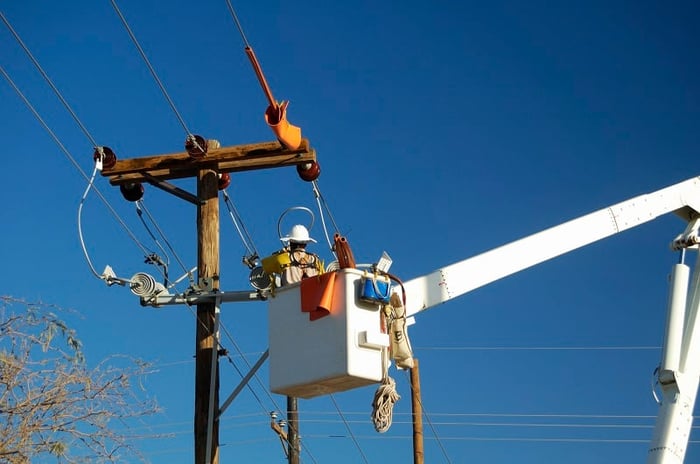
Gleichzeitig erreichen Netzanlagen das Ende ihrer Lebensdauer, und Stürme sowie Naturkatastrophen, die die alternde Infrastruktur bedrohen, treten immer häufiger auf. Ältere Infrastruktur verschleißt tendenziell schneller, da extreme Temperaturen und Stürme ihren Tribut fordern. Diese Faktoren machen das Stromnetz anfälliger für kostspielige und oft gefährliche Ausfälle.
Swiss Re stellte fest, dass zwischen 2012 und 2023 jeder dritte Stromausfall in den USA durch ein Unwetter verursacht wurde. Verbundene Stromnetze und großflächige Wetterereignisse können erhebliche Probleme verursachen, die sich über ganze Regionen erstrecken. Im September 2026 führte der Sturm „Austin“ zu Stromausfällen in 300.000 Haushalten in Frankreich und weiteren 12.000 im Vereinigten Königreich. Aktuelle Vorhersagemodelle schätzen, dass bei Stürmen hoher Intensität bis zu 34 % der Freileitungen im Vereinigten Königreich ausfallen könnten. Auch die kanadischen Stromnetze waren bereits von ähnlichen wetterbedingten Ausfällen betroffen, wie beispielsweise im Jahr 2025, als ein Frühlings-Eissturm 300.000 Haushalte sowohl in Ontario als auch in Québec von der Stromversorgung abschnitt.
Steigende Sommertemperaturen führen dazu, dass Transformatoren und Umspannwerke schneller verschleißen und ein erhöhtes Kurzschlussrisiko besteht. Hohe Temperaturen können zudem dazu führen, dass Freileitungen überhitzen. In den USA führte eine Hitzewelle im Pazifischen Nordwesten im Jahr 2021 zu Temperaturen von über 40 °C, wodurch Stromkabel schmolzen.
Der Klimawandel birgt potenziell langfristige, generationenübergreifende Risiken, die die heutigen Betreiber bei der Modernisierung und dem Ausbau der Infrastruktur berücksichtigen müssen. Die typische Lebensdauer eines großen Transformators beträgt etwa 40 Jahre, wobei Planung und Genehmigungsverfahren bis zu einem Jahrzehnt in Anspruch nehmen können. Sollte die globale Erwärmung zu einem Anstieg der Durchschnittstemperaturen um 2 °C bis 4 °C führen, könnte sich diese Lebensdauer bis zum Ende des Jahrhunderts um 20 % bis 40 % verkürzen. Nach Angaben der Vereinten Nationen genehmigen Regierungen Strominfrastrukturen mit einer geschätzten Lebensdauer von 15 bis 20 Jahren auf der Grundlage historischer Wetterdaten, die die Veränderungen der kommenden Jahrzehnte nicht widerspiegeln.
Netzbetreiber müssen bei der Planung der nächsten Generation des Stromnetzes klimatische Herausforderungen berücksichtigen, was die Bewältigung des steigenden Energiebedarfs zusätzlich erschwert. Sie benötigen effektivere Methoden zur Überwachung des Zustands der Anlagen, zur Erkennung von Ausfällen sowie zur Durchführung von Maßnahmen zur Schadensminderung und -behebung, wenn sie den Betrieb in den kommenden Jahrzehnten aufrechterhalten wollen.
Wie Energieversorger KI-gestützte georäumliche Arbeitsabläufe nutzen, um das Stromnetz zu stärken
Modernisierung der Arbeitsmittel für den Außendienst bei Versorgungsunternehmen
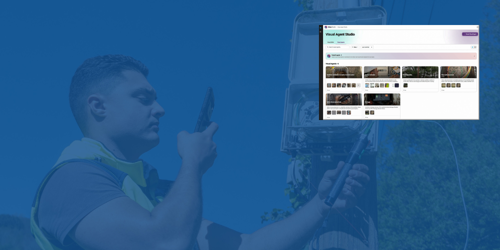
Feldtools, die zur Unterstützung moderner Versorgungsbetriebe entwickelt wurden, bieten Funktionen wie KI-gestützte Bildanalyse und Datenerfassung, Zugriff auf den digitalen Zwilling des Netzes, maßgeschneiderte Formulare und Arbeitsabläufe sowie Fehlererkennung in Echtzeit. Sie machen die Arbeit vor Ort effizienter, indem sie Ingenieure durch vordefinierte Kontrollpunkte führen und die Qualitätssicherung (QA/QC) in jeder Phase des Arbeitsablaufs automatisieren. Gleichzeitig integrieren sie die Datenerfassung und -validierung in die Routine der Ingenieure, sodass der digitale Zwilling kontinuierlich mit Erkenntnissen aus der Praxis aktualisiert wird. Diese Tools müssen zudem offline funktionieren, damit Teams in Gebieten mit geringer oder gar keiner Netzabdeckung wie gewohnt und ohne Unterbrechungen darauf zugreifen können.
Transkript anzeigen
Welcome back to Bite Size Electric,
where we unpack the ideas and innovations
that are reshaping how utilities work,
one bite at a time.
I'm your host,
Brandon Kirkin,
and today we're diving into one of the
biggest shifts happening across the industry,
geospatial work execution.
Geospatial work execution is a process in
which utilities connect their field crews,
office teams,
and enterprise systems around a single live view of the grid.
It's about moving from static digital twins to living,
adaptive networks where every job inspection or asset
update happens in the real world context of the grid.
To help us unpack this,
I'm joined by Adrian McNulty from IQGeo. Adrian has been working
with utilities around the world to help them transform their
operations using geospatial work execution and AI driven workflows.
Adrian, welcome to Bite Size Electric.
Oh, thank you for having me, Brandon.
So Adrian,
I think the best place to start would be
actually defining what we're talking about.
Can you explain what geospatial work
execution means in practical terms?
Yeah.
So,
geospatial work execution,
it's really about performing the work in the field,
but think of it as having full geospatial awareness,
awareness of the network model,
but also workflow intelligence.
You know,
there's a lot of traditional systems out there that
they're good at maintaining asset records or work management
systems that tell you where to go and who to go to.
No one's really combining it all together.
So think of combining all in one application,
the context of a network model.
So the underlying data model, the attribution,
Why it's really profitable.
massive push around electrification and renewables.
All of this is leading to extra work in the field,
whether it's design work,
as-built work,
inspections,
response to unplanned work.
When I talk to utilities,
it's not uncommon that we see several different applications
covering different types of work.
It could be as simple as planned versus unplanned,
but even further breakdowns,
very siloed work types in different applications.
But I think it's really important that we focus
on making it easier for the field crews to
perform the work.
They could have multiple different
types of work to do on a daily basis
and may have to context switch across different applications.
But I also think why it should be
now is
there's going to be further technology transformations that
the future platforms need
to be enabled for.
And by that,
I mean AI and how's that going to work in the field in the future.
So I know that utilities already have
a lot of existing systems like GIS,
work management,
asset management,
but it sounds like these tools aren't
really enabling geospatial work execution.
So what's missing from these traditional
tools that's causing these challenges?
Yeah, that's a great question.
I might answer in a slightly different way if it's okay.
I don't think it's what's missing in the existing tools,
but I think it's more of a case of
combining or consolidating different work into one application.
You know,
it's not uncommon that you see multiple different
mobile applications and many of them were
or are
extensions of a desktop application,
right?
And then mobilized.
I think what's missing is having a
true mobile application,
one that's designed for the field.
Easy to use,
works online, offline on any
different device.
You can give it to contractors,
but combines all the different things that you need to do in
the field,
whether it's located an asset and being able
to trace upstream and downstream to see what's
connected or what customers are connected,
right?
Whether it is,
hey,
I'm in the field and the network
model said there should be a poll here,
but there's no poll here
and doing data edits and corrections and
making those get back in.
But also then the different types of
work that you could be assigned during
the day
and all having a view of it,
all the steps and links back to other types of information,
whether it's
safety documents,
whether it's inspection history,
whether it's links to the actual asset documentation
itself,
all in an easy to use app
and completely digital workflow.
So everything you do is fully
tracked.
I think that's what's missing today and the
challenge of having too many applications that
potentially could have different data.
And I think one of the big challenges,
as you know, Brandon,
the systems that we're putting in place today to
actually control the grids require high degree of
accuracy and up to date of the actual data itself.
And the more different systems we have,
the more prone we are to errors.
So we can combine all these,
digitize all of the work steps,
make it easier for the people in the field.
The back office systems will have better data as well.
So I'm understanding that geospatial
work execution is really a process.
What would you say are the core components of
geospatial work execution that makes it different
from traditional processes?
Yeah, I think you're right.
It is a process.
There's inter-end
workflows that extend from different source
systems into the field and back again.
And if they think of the actual impact of the field,
the different components, I think there's
five.
So first of all,
it's the concept of having the full network model,
being able to edit in the
field, but having it up to date.
If you make an edit in the field,
being able to push it back into the
source system as it happens.
So reducing the lag of things that happen in the field,
but into the
back in system and then back out to the field again.
Native mobility, I think, is understated,
right?
So having the ability to deploy it on different mobile devices,
whether that's an
iOS device,
an Android device,
or Windows device,
but also being able to work through online and
offline connectivity,
or even low connectivity.
We need the field crews to be able to continue
their work regardless of what the connectivity is.
The next piece is then the configurable workflows.
So there's different workflows and steps
of a workflow for different types of work,
whether you're
looking at a design or an as-build or an
inspection or response to unplanned work.
These all require
different workflows and steps.
So it's important that we're able to configure those.
I think it's
also now, I think AI is like the next frontier.
It's important that whatever we deploy in the field
enables AI in the future,
or actually today,
not just today,
but in the future as well.
I think the
final piece is integration to make sure
we've got the end-to-end processes.
So generating the work
orders,
all the information around the work order,
getting that into the hands of the field worker.
The field workers perform the work in the field,
but making sure that goes in to the back office
applications or the source systems quickly and accurately.
So there's no data lab and the data
quality increases.
Awesome.
So this sounds really impactful at a high level,
but can you describe
what this looks like for a utility crew in the field?
Like how does this actually change their day-to-day
experience?
Yeah,
I think the best way to do it,
let's think of a day in life,
right?
So imagine,
Brandon,
you turn up at work,
you get to the utility crew for the day,
and you sync your IQ Geo app.
You open it up and you've got an up-to-date network model
overlaid onto a map and all your assigned
work for the day.
When you get into your individual work orders,
you've got access to all different
types of information that could be specific to that work order,
whether it's a permit,
whether it's a
safety document,
whether it's different steps that
you have to do to execute that work.
But you've got a guided process within the
application to execute the work from start to finish.
You can take images.
In some instances,
you may have AI-enabled workflows where the images you're
taking are validating work while you're in the
field to give you the confidence that you've done
the work right first time.
And then everything you do is logged.
You've got a full audit trail of every
edit you make,
every piece of work you execute,
but a full digital audit trail that's integrated back
into the back office systems.
Great.
Okay.
So I'd like to dive a little bit further into
something you mentioned earlier as one of the core
components.
And then again,
about the field crew is the role of
AI. AI is pretty much everywhere today.
And it sounds like it's also a big part of this shift as well.
How does AI actually enhance geospatial
work execution?
Yeah,
I think that AI is the next level of
transformation when it comes to workflows in the
field.
There's been a lot of work around
digitizing current workflows in the field.
So replacing paper
with digital processes,
going away from paper forms to digital forms.
And don't get me wrong,
these are tremendous value,
but there's so much more we can do.
Putting the network model, native
mobility,
and the workflows into the app for the field user,
I think it builds the basis to add
AI-enabled workflows and in the future,
agentic workflows to support all different types of tasks
in the field.
So what does that really mean?
And I think AI transformation can happen in a number of
different ways.
We can look at real-time validation,
and this is available today.
So using or introducing
images
into the workflow.
So imagine you're installing a piece of equipment and the workflow
requires different images to be taken along the way.
When you get to the job site,
maybe you're doing a
meter install, you take a meter read,
you take an image of the pit to make sure it's clean,
you install the meter,
you check the connections with an image,
you check the asset number,
all of
this is done automated in the background
and the model locally in the field,
and it gives you that
instant validation.
The next step there is guidance.
So we're starting to move into AI-guided
steps along
the flow.
This could be flagging issue before they become
a problem or reducing all the manual steps.
Over time,
I think we'll get into predictive workflows.
So the AI models learn what's happening and provide
guidance on what we should do.
And we get into the future of true agentic automation.
Imagine you're
doing an inspection.
The image identifies a crack in a pole,
for example,
and the AI agent automatically
creates a referral to come and replace
the pole based on the condition.
So I think there's a lot
of areas where AI is going to help.
But I think what's important is to do it in a way that actually
helps the crews complete their work on a
daily basis rather than being intrusive.
Awesome.
Okay.
So it sounds like AI can be helpful both in
validation and also in the actual decision
making process for some of these workflows.
Can you give us an example of maybe a common workflow
that you see utilities doing nowadays that you
think AI could really help make much more efficient?
Yeah, there's actually two I can think of.
First one is we do quite a lot of inspections.
Think of
right-of-way or transmission structures.
Even gas
utilities do a lot of regulatory inspections.
What we're seeing is a high interest in many of
our customers actually are taking imagery of the,
let's use transmission right-of-way as an example.
They're taking imagery with drones
as they do the
manual inspection process.
So they still go into the field with
ITG on an iPad as they've got a set
of forms and they're using their own eyes to check what's going on.
But in parallel, they're taking
images along the way of whether it's the span or the structure.
So we're building models that will
automate the inspection process.
Initially, that will be done in a batch process.
So allow them to
continue with a manual process,
take all the imagery,
load it all in at the end of the day,
and the models verify what was recorded locally.
In the future,
that could just automate the process
so we could really get towards a drone-driven inspection process.
The other one is around
installation of equipment.
So I mentioned meters earlier because
I think it's a fairly common one
right now.
So using AI models to verify the installation
of a meter has happened correctly
and safely with the right permits or the meter routes.
Those are things that we're seeing quite
common today,
but I think it'll go to other use cases in the future,
such as as-built,
such as damage
assessment.
I think there's a whole area where we could add this into.
Great.
Wow. Yeah.
That really paints a picture of how powerful that could be.
It sounds like geospatial work execution,
this process is really setting up utilities for much more
efficient workflows in the future.
Is that where you see this heading?
Could we eventually reach a
point where the network becomes self-updating,
like an intelligent grid that can detect and
validate everything automatically?
I think there's two questions there, I think.
So one around the
efficiency and productivity of the crews.
So let me take that one first.
So I'm going to give you an
example.
I sat with a utility a couple of months ago,
and they were walking through how they do their
current response to outages.
And they actually showed me that they jumped between two or three
different applications.
One to get the network model and spatial awareness,
and then one to fill
out the forms related to the actual outreach ticket themselves.
And what we've done, we've built a
solution that basically all inside IQGL,
all inside one application,
but a fundamental network model,
and WordPress specifically designed for outreach management.
But then in the same application,
there could be other work order types.
So they can stay in one application to all of the works,
driving much more efficiency,
but also the data quality.
Because sometimes you've got different data
in different systems,
so having it all in common will improve data quality,
efficiency,
and get the data back into the other systems.
And Brandon,
to the question around self-updating
networks,
I think absolutely that's where we should be heading.
So as utilities start to adopt
geospatial work execution and layer in AI,
I think where we evolved from is more static data into an
intelligent living system that helps us on a day-to-day basis.
And that takes a number of different
forms in my mind.
So we've touched on it in different questions you asked me earlier,
but
like the real-time validation,
as you do work,
performing the field,
using AI models and imagery
to make sure what we're doing is done right first time,
done safely.
You can even take that a step
further,
having validation from the field before you go out.
Imagine a customer wants a new meter
connection and they take an image or a video of it first,
they send it in,
you know exactly where
it's located,
you know what's going on before you get to the job site.
Then we get into like
automation and detection.
As you know,
there's more and more sensors getting put on the grid today,
inside the substation,
outside of the substation,
or automated equipment.
So there's more and more
knowledge of what's happening across the grid,
all the way down to the edge.
And the next area I think is
around agentic workflows.
The AI agents don't just flag issues,
but can actually create what needs to happen
next.
So if it's a follow on piece of work,
get it back into the source system and automatically
generate,
whether it's a tree trimming or a pole replacement.
Leading on from the sensors and all
the new measurement devices we have on the field,
that enables us to be more predictive and to take
more prescriptive actions around replacing
equipment and different types of actions.
And then continuous
learning.
The system will learn the more data we
put into it and every job it executes,
every image it reads.
So over time,
it's going to know how to adapt and make it smarter.
So I think absolutely,
I'm not sure how long it will take us to get to a full self
updating network in the field,
but I think that's the path we should aspire to.
I just wanted to ask a quick follow up to what
you had mentioned about how AI learns and gets a
little bit better as you put more data into it and as it's exercised.
How long would it really take
then for this to be useful?
Is this the kind of thing that,
you know,
you get this in the field,
but it's not really useful for a bit until you
start using it more and more and then eventually
it becomes actually useful?
Or is this something that you can actually use right away on day one?
So that's a really good question, Brandon.
So for our listeners,
IQgeo acquired a company about
Deepomatic early this year.
They focus on visual AI,
but specifically for utilities and telcos,
more interesting is in the field as well.
So validating the work that's been done.
And traditionally they have been in the space for almost a decade.
I think last year they processed
something like a hundred million images so they can work at scale.
And traditionally they've been
more of a discriminative AI. So using very
specific images to train the models over time.
And that can
take some time.
So you're using the individual customers
imagery of a good image versus a bad image
and training the models.
And they just get
smarter and smarter and smarter,
but it does take time.
The benefit though, they're highly accurate.
What we've done recently is blend generative AI. So think
now large language models.
They've got a mass amount of data
that can help accelerate the training
of the model itself
in parallel to feeding the specific images
from the customer's data set as well.
So as a long winded answer of saying,
we're now looking and deploying ways of accelerating the
learning curve.
What's important though is that we keep the
accuracy for certain types of inspections.
Adrian, thank you so much.
This has been great.
I really appreciate the details you put into your
answers here.
I have one last question for you,
just kind of a quick wrap up one.
For any utility
executive or field leader out there who's listening
and thinking this really sounds like the next big
step for us.
What's one piece of advice to give them before
starting their geospatial work execution
journey?
Adrian,
I think my recommendation is pretty simple is
start small, but scale fast.
And what I mean by
that is,
I think we need to look at a broad scale around
how do we make field operations more efficient,
both now and in the future.
But trying to do it all in one project
is going to be very, very hard.
Where I've seen success with other utilities,
they pick
one use case that's problematic
or an aging
application and focus on that,
but really focus on getting it into
the hands of the field users very,
very quickly and then iterate,
make it better over time.
It doesn't have to be perfect from day one.
And then from there,
migrate workloads into the same application.
So rather than having a single project that lasts several years,
you have maybe these quarter releases
where every release is either an iteration
on the workflow itself or a new workflow,
new work order type gets put into the application.
I think it's also important to start to look to
introduce AI. Like it or not,
I think it's going to be around and it's going to stay.
So I think we
could look at,
or I'd recommend looking at workflows where
you can introduce AI technology today in a
non-intrusive manner.
And I'd mentioned earlier in some of your questions,
the inspections or the meter
installation process,
those two to me seem pretty good candidates
to do an initial use case because
the models are fairly easy to build and
to train against what you would look for.
And you can do it in
line with the current workflow today without being
intrusive and you'll get a fully automated QAQC process
along with it.
Great.
Adrian,
thanks so much for joining us today and
for breaking down what geospatial work
execution really means for utilities.
No, thank you for having me, Brandon.
It's been great to be on.
And as we've heard,
it's not about better maps or new applications.
It's about connecting people,
workflows and data in real time,
and obviously using AI to make every job faster,
safer and more
accurate.
To learn more,
visit iqgeo.com and stay tuned for our
upcoming episodes where we'll explore
how visual AI is transforming each stage of utility operations,
from design and construction to
inspections and storm recovery.
I'm Brandon Kurgan,
and this has been Bitesize Electric.
See you next time.
Arbeiten, bei denen alles gleich beim ersten Mal richtig gemacht wird, ermöglichen
Da die Betreiber den Bau und die Modernisierung des Stromnetzes vorantreiben, um den Energiebedarf zu decken, benötigen sie effektivere Methoden, um Ingenieure auszubilden und eine gleichbleibend hohe Arbeitsqualität zu gewährleisten – unabhängig davon, wer die Arbeiten ausführt, sei es ein Team von Auftragnehmern oder neue Mitarbeiter.
KI-gestützte Tools können geführte Arbeitsabläufe bereitstellen, die Arbeit in Echtzeit überprüfen und sofort Feedback geben, um sicherzustellen, dass die Techniker ihre Aufträge jedes Mal gemäß den Standards des Betreibers ausführen. Mit KI-gestützten QA/QC-Arbeitsabläufen können Techniker ihre Arbeit schneller und mit größerer Sicherheit erledigen. Sie müssen nicht darauf warten, dass die Validierung aus dem Backoffice eintrifft, sodass sie schneller mit der nächsten Aufgabe beginnen oder zum nächsten Einsatzort weiterfahren können.
KI-gesteuerte Arbeitsabläufe ermöglichen es den Betreibern, ihre Qualitätsstandards in unbegrenztem Umfang durchzusetzen und sicherzustellen, dass jeder Auftrag auf Anhieb korrekt ausgeführt wird, wodurch kostspielige Nacharbeiten entfallen. Wenn Versorgungsunternehmen eine bessere Kontrolle über die Qualität der Arbeiten an jedem Standort haben, können sie ein widerstandsfähigeres Netz aufbauen, das zuverlässig funktioniert und länger hält. Dies senkt die Kosten, schützt die kritische Energieinfrastruktur und stärkt das Vertrauen der Kunden.
Daten in Erkenntnisse umwandeln
Ingenieure benötigen zudem vor Ort einen nahtlosen Zugriff auf das Netzmodell – auch offline –, damit sie sich vor Arbeitsbeginn ein umfassendes Bild vom genauen Standort und Zustand einer Anlage machen können. Dank einer einheitlichen Plattform, auf der präzise, durch KI validierte Netzdaten zentralisiert werden, können Ingenieure die Historie jeder Anlage direkt neben den Details ihres aktuellen Arbeitsauftrags einsehen. Dies erleichtert es ihnen, Anlagen sicher zu lokalisieren und fundierte Entscheidungen über ihre nächsten Schritte zu treffen.
Im Backoffice extrahieren KI-Tools Daten aus den Fotos, die die Techniker aufnehmen, und wandeln diese in verwertbare Erkenntnisse um, die als Grundlage für betriebliche Entscheidungen dienen. Anstatt zu raten, wissen die Betreiber nun genau, was zu tun ist, um eine optimale Leistung im gesamten Netz aufrechtzuerhalten.
Der Übergang von einem reaktiven zu einem widerstandsfähigen Netzmanagement
Um Ausfälle proaktiv zu verhindern und darauf zu reagieren sowie die Ausfallsicherheit zu verbessern, benötigen Betreiber von Versorgungsnetzen einen besseren Überblick über das gesamte Netz. KI-gestützte Tools leiten Daten aus dem Feld sofort an den digitalen Zwilling weiter, sodass die Betreiber in Echtzeit einen aktuellen Überblick darüber erhalten, was tatsächlich vor sich geht. Während die Anlagen dokumentiert werden, erstellt das System eine lückenlose Historie der Anlagenleistung. So können Betreiber Schwachstellen erkennen und feststellen, wann Anlagen das Ende ihres Lebenszyklus erreichen, noch bevor sie Probleme verursachen.
KI-Agenten können Anlagen auf Anzeichen von Schäden, Verschleiß oder mangelhafter Ausführung überprüfen. Sie können den Gesamtzustand, das Alter und den Standort der Anlagen analysieren und anschließend proaktive Wartungsmaßnahmen vorschlagen, die von den Backoffice-Teams genehmigt werden können, oder automatisch Arbeitsaufträge erstellen und Einsatzteams entsenden. Dies ermöglicht es den Betreibern, Störungen zu erkennen, bevor sie sich auf das Netz auswirken.
KI-Agenten verbessern zudem die Leistung der Einsatzkräfte bei Stromausfällen und im Katastropheneinsatz. Außendienstmitarbeiter können sich auf KI-gestützte Arbeitsabläufe verlassen, die sie durch Verfahren unter hohem Druck führen. Da sie die Netzdaten immer zur Hand haben, können Ingenieure vor Ort schnell die richtigen Anlagen ausfindig machen und fundierte Entscheidungen treffen. Dies verringert menschliche Fehler, die unter sich rasch ändernden Umständen während oder unmittelbar nach einem größeren Stromausfall häufiger auftreten.
Im Laufe der Zeit können die Betreiber erkennen, wo die größten Gefahren für das Stromnetz liegen – von Wetterbedingungen bis hin zu in das Netz hineinragender Infrastruktur –, sodass sie bei der Planung und Auslegung bekannte Risiken berücksichtigen können.
Transkript anzeigen
Also,
IQGeo,
wir sind ein Softwareunternehmen und bieten eine Geodatenlösung an,
die sich in erster Linie an Außendienstmitarbeiter von Versorgungsunternehmen richtet.
Wir
haben also im Grunde alle
Daten aus GIS- und EAM-Systemen neu aufbereitet
und in eine einfache,
benutzerfreundliche Anwendung integriert, die sowohl online als auch
offline funktioniert und die Arbeitsaufträge den physischen Anlagen zuordnet.
Im Versorgungssektor ist derzeit viel los.
All die Veränderungen, die Sie erwähnt haben –
die Modernisierung des Stromnetzes –,
all das erhöht das Arbeitsvolumen, das
von den Mitarbeitern tagtäglich bewältigt werden muss.
Wir beobachten bei vielen unserer Kunden,
dass sie entweder veraltete Anwendungen haben, die ersetzt werden müssen,
oder dass die Außendienstmitarbeiter im Laufe eines einzigen Tages
Anwendungen hin und her.
Viele der Anwendungen verfügen nur über eine begrenzte räumliche Wahrnehmung
oder sind nicht direkt mit dem Netzmodell verbunden.
Mit
IQGeo
verbinden wir das physische Netzmodell mit den
Arbeitsaufgaben und verknüpfen sowohl die Anlage als auch die Arbeit miteinander –
und das alles in einer benutzerfreundlichen Anwendung.
Dadurch wird die Arbeit für die Außendienstmitarbeiter vor Ort optimiert.
KI steht derzeit im Mittelpunkt jeder Diskussion,
sei es im Backoffice oder im Außendienst.
Viele Versorgungsunternehmen machen bereits heute
Fotos bei ihren Inspektionen,
egal ob sie Stromausfälle beheben
oder welche anderen Aufgaben sie gerade erledigen.
Was sie jedoch nicht tun, ist, die in den Bildern enthaltenen Daten zu nutzen.
Mit
visuellen KI-Techniken
kann man also tatsächlich automatisieren, was ein Mensch sonst manuell
erledigen würde, und dies direkt mit der jeweiligen Aufgabe verknüpfen.
Meine Empfehlung wäre, klein anzufangen.
Man sollte den Arbeitsablauf finden, in dem bereits heute Bilder verwendet werden.
So
verändert man die Benutzererfahrung im Außendienst nicht,
sondern automatisiert und vereinfacht den Prozess
und mit weniger Aufwand mehr Arbeit zu erledigen.
Wenn ich heute mit Versorgungsunternehmen spreche,
ist meiner Meinung nach eine der größten Herausforderungen, dass
ein Außendienstmitarbeiter möglicherweise mehrere Anwendungen nutzen muss,
auf die er zugreifen muss, um seine Arbeit zu erledigen.
Gleichzeitig versuchen sie aber auch, sehr komplexe Daten zu verbreiten.
Daher
glaube ich, dass es entscheidend ist, es den
Außendienstmitarbeitern leicht zu machen, ihre Arbeit zu erledigen – und zwar sicher.
Also,
integrieren Sie alles in eine Anwendung, die online
und offline funktioniert,
einfach zu bedienen ist,
ihnen aber Zugriff auf alle Daten gewährt
und sowohl das Netzmodell als auch die Arbeit, die sie
ausführen möchten, in einem benutzerfreundlichen Arbeitsablauf miteinander verknüpft.
Also, schauen wir mal.
Bereiten Sie Ihren Netzbetrieb mit IQGeo auf die Zukunft vor
Versorgungsunternehmen wie „TEPCO “, „Power Grid“ und die „Bolivar Energy Authority“ nutzen IQGeo bereits, um sich einen unvergleichlichen georäumlichen Überblick über Katastrophenschäden zu verschaffen und eine intuitive GIS-Mobilität im Außendienst zu ermöglichen. Mit IQGeo können Betreiber die Effizienz im Außendienst durch KI-gestützte Arbeitsabläufe steigern, wodurch die Sicherheit erhöht und die Datengenauigkeit verbessert wird. Darüber hinaus können Betreiber mit IQGeo ihren Einsatzteams vor Ort in Echtzeit Netzdaten und aktuelle Lageberichte bereitstellen, wodurch Wartungs- und Sanierungsarbeiten beschleunigt werden – für eine höhere Widerstandsfähigkeit und eine schnellere Wiederherstellung nach Katastrophen.